How 3D Site Plan Rendering Helps Developers Present Projects to Investors
3D Site Plan Rendering
Securing capital for large-scale real estate developments requires far more than solid financial models and land control agreements. Institutional investors, private equity partners, and commercial lenders evaluate risk based on absolute clarity. They need to see exactly how a proposed project will integrate with its surroundings, function operationally, and generate long-term yield. Traditional two-dimensional civil blueprints, flat land surveys, and schematic black-and-white site plans often fall short of communicating a project’s true potential. However, incorporating professional 3D site plan rendering bridges the critical gap between complex civil engineering data and high-level investment vision. By converting technical spatial data into rich, immersive visuals, real estate developers can clearly illustrate property density, vehicular flow, spatial dynamics, and architectural intent during high-stakes presentations. Consequently, utilizing advanced 3D rendering for development proposals has transformed from an optional marketing asset into a strategic prerequisite for capital raising across the USA.
Bridging the Gap Between Engineering Blueprints and Investment Vision
In today’s competitive real estate investment market, investment committees review dozens of prospective deals each month. Pitch decks that rely strictly on dense engineering notation and flat floor plans place a heavy cognitive burden on stakeholders who may not possess background experience in civil drafting. As a result, when reviewers must decipher complex setbacks, utility easements, and grading topography on their own, the core value proposition of the project can easily get lost.
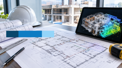
Fortunately, an intuitive real estate site plan rendering translates abstract technical data into an immediately accessible, photorealistic visual asset. Lenders and joint-venture partners can quickly evaluate critical development variables, such as building heights, parking layout allocations, pedestrian pathways, and access points without getting bogged down in technical schematics. Furthermore, working alongside specialized visualization firms that deliver full-scale 3D rendering services ensures that every dimension of the pitch deck—from elevation nuances to environmental orientation—is presented with accurate spatial perspective, building immediate confidence among financial partners.
Capturing Macro Scale with Aerial and Master Plan Visuals
For commercial hubs, industrial logistics parks, and multi-family residential master plans, site context is everything. Investors must understand how a proposed development connects with the broader surrounding infrastructure, including nearby transit corridors, neighboring retail districts, and adjacent natural features.
Visualizing Macro Scale with Aerial Perspectives
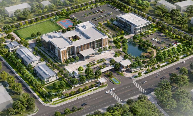
An elevated aerial 3D rendering offers a comprehensive bird’s-eye view that captures the full project site within its real-world neighborhood environment. This high-altitude perspective effectively highlights major selling points, including proximity to interstate highways, surrounding urban density, ingress and egress configurations, and expansion potential. Therefore, it provides financial decision-makers with a clear, macro-level overview of how the asset fits into local municipal growth corridors.
Structuring Complex 3D Master Plan Renderings
For multi-phase or mixed-use developments, a cohesive master plan visualization outlines a clear roadmap for long-term equity creation. When pitching high-density mixed-use assets using detailed commercial renderings, developers can visually separate phase-one construction from future expansion land, outline shared parking facilities, and demonstrate traffic mitigation measures. Ultimately, this level of visual organization helps investors evaluate risk profiles and capital allocation schedules across each development phase.
Integrating Facades, Landscapes, and Interior Context
A compelling site plan presentation does not isolate land development from architectural experience. Instead, it weaves site layouts, structural design, and environmental details into a unified story.
To provide equity partners with a complete view of the finished asset, development teams combine site layout models with specialized architectural views:
-
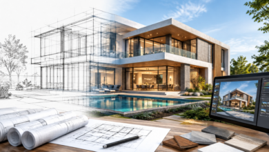
Structural Integration: Incorporating photorealistic 3D exterior rendering services showcases facade materials, exterior lighting strategies, and structural proportions directly within the site footprint.
-
Environmental Harmony: In addition, integrating detailed landscape rendering highlights green spaces, retention basins, outdoor seating plazas, and tree lines, elevating the aesthetic appeal and projected valuation of the property.
-
Interior and Operational Flow: For multi-family and mixed-use projects, linking site-wide visuals with high-precision 3D interior rendering services allows investors to follow the tenant journey smoothly from entry gates and parking garages into lobby reception areas and private units.
Similarly, for master-planned residential communities, utilizing customized residential rendering solutions helps portray neighborhood character, streetscapes, and community amenities that directly drive projected absorption rates and unit sales.
Elevating Technical Accuracy and AEC Discipline
While striking graphics capture initial investor attention, rigorous technical accuracy secures their final commitment. Institutional capital sources frequently bring experienced construction managers and civil engineers to perform due diligence on pitch materials. Thus, if a rendering distorts site boundaries, ignores slope gradients, or misrepresents zoning setbacks, it raises immediate red flags regarding developer credibility and project execution risk.
To prevent this issue, leading AEC documentation and drafting specialists like McLine Studios ground their visualization process directly in authentic architectural, structural, and BIM data. By building site visualizations on precise underlying CAD shop drawings and civil surveys, visualization experts deliver site renderings that strictly honor municipal zoning limits, utility corridors, and topographic constraints. Demonstrating this degree of technical discipline proves to investors that the proposal is not merely an artistic conceptualization but a buildable, permit-ready asset.
De-risking Capital Commitments and Accelerating Approvals
Real estate investment decisions fundamentally center on risk mitigation. Integrating high-resolution 3D site plan rendering assets into initial funding requests systematically reduces perceived investment risk. Visualizing site logistics early allows project managers to spot potential design oversights, traffic bottlenecks, or shadow obstructions well before breaking ground. Consequently, developers can resolve layout conflicts prior to formal plan submittal, avoiding costly engineering revisions during pre-construction.
Furthermore, these visual assets offer significant multi-channel utility beyond private capital presentations. The exact same high-impact site visuals created for investor decks can be utilized during public planning board meetings, municipal zoning hearings, and early pre-leasing marketing campaigns. As a result, developers can streamline the entitlement process and accelerate the overall timeline to groundbreaking.
Streamlining Future Pitch Success
In the modern USA commercial real estate market, relying solely on flat two-dimensional civil drawings to pitch multi-million dollar projects is a missed opportunity. On the other hand, integrating high-quality 3D site plan rendering converts abstract engineering data into compelling, easily digestible visual narratives. By unifying precise land planning, realistic exterior elevations, and aerial neighborhood context, real estate developers can clearly demonstrate project feasibility, align with investor expectations, and close capital raises far more efficiently.
Natural Call to Action (CTA)
Ready to elevate your next development pitch? Upgrade your investor presentations with high-precision 3D site plan renderings and architectural visualization assets that turn complex engineering concepts into compelling funding opportunities. Partner with experienced AEC visualization experts to bring your site layouts to life.